Bottom Line Up Front
Deploying a drone for property claims documentation cuts your roof assessment time by 75% while delivering 4K evidence that carriers can’t dispute. The key isn’t just getting aerial shots — it’s integrating drone data into your Xactimate scope, moisture mapping workflow, and supplement strategy to build bulletproof claim files that close faster.
Understanding Drone Applications in Claims Work
FNOL and Initial Assessment
When you get that initial call about hail damage or wind loss, your drone becomes your first line adjuster. Before you commit to representation, deploy the drone to validate the claimed damage scope. You’re looking for impact marks on gutters, granule loss patterns, and exposed nail heads that indicate legitimate wind uplift — not the cosmetic damage that wastes everyone’s time.
Your drone assessment during FNOL should answer three questions: Is there compensable damage? What’s the preliminary scope of loss? Can you justify your fee against the likely settlement value? Skip the ladder work for this initial qualifying flight — you’re gathering intelligence, not building the claim file yet.
Document your flight path and capture settings immediately. Carriers increasingly challenge drone evidence based on flight date, weather conditions, and image metadata. Your initial assessment photos need timestamps that align with your representation agreement and prove damage existed when you took the claim.
Building Your Evidence Package
Professional-grade documentation separates six-figure settlements from nuisance payments. Your drone workflow should capture overlapping high-resolution images at multiple altitudes — wide establishing shots, medium-range damage documentation, and close-up detail work that shows individual impact points or membrane failures.
Focus your flight plan on cardinal directions plus corners. Each roof plane needs comprehensive coverage, but pay special attention to north-facing slopes where wind-driven rain causes the most interior damage, and south-facing exposures where UV degradation complicates age-of-damage arguments.
Integrate thermal imaging capabilities during your drone flights. Temperature differentials reveal moisture intrusion that ground-level moisture mapping might miss. When you find thermal anomalies, mark GPS coordinates for follow-up with handheld thermal cameras and invasive moisture detection.
Integrating Drone Data into Your Scope of Loss
Xactimate Integration and Line-Item Support
Your drone photos need to justify every line item in your estimate. When you write “Replace hip shingles” in Xactimate, your aerial footage should show specific impact damage to those hip areas with enough detail that a desk adjuster can’t question the necessity.
Create a systematic approach: drone overview shots for quantity verification, close-ups for damage substantiation. If you’re claiming 47 squares of replacement, your aerial survey should provide measurable visual confirmation of that scope. Use your drone’s GPS mapping to verify the roof sketch measurements you’ll input into Xactimate.
Tag your drone images with specific Xactimate line item references before uploading to your claim file. When the carrier desk adjuster reviews your estimate, they should be able to match each significant line item to corresponding aerial evidence without hunting through your photo library.
Code Upgrade and Matching Documentation
Aerial perspectives reveal code compliance issues that ground inspection misses. Your drone captures the full roof system context — showing how new material installation requires coordinated upgrades across multiple roof planes to meet current building codes.
Document the existing material condition comprehensively. When you’re arguing for matching on a partial loss, your aerial footage needs to show the full roof system’s age, weathering patterns, and material degradation. Capture the color variation, granule loss, and weathering that makes partial replacement visually inconsistent with the existing roof system.
Use your drone to establish the logical repair boundaries that support O&P inclusion. Aerial documentation should clearly show why the repair requires coordination across multiple roof planes, justifying overhead and profit on the entire coordinated scope rather than isolated line items.
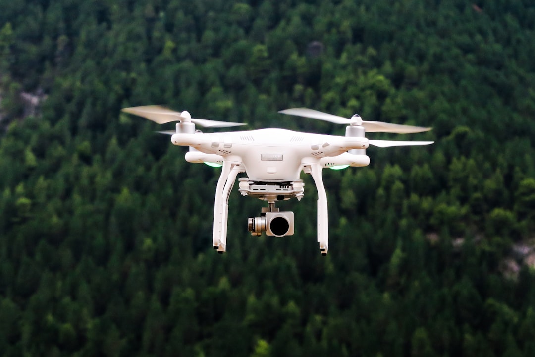
Technology Stack and Equipment Standards
Hardware Requirements for Claims Work
Your drone platform needs to exceed insurance carrier technical standards, not just meet them. Deploy equipment that captures 4K video and 20+ megapixel stills with optical image stabilization. When you’re building evidence for a contested claim heading to appraisal, image quality becomes a credibility factor.
Invest in dual-battery systems and rapid charging capability. You can’t afford equipment failures during your documentation window, especially when weather conditions limit your available flight days. Your backup equipment should match your primary platform’s capabilities — not just provide emergency coverage.
Consider integrated LiDAR capabilities for complex commercial claims or residential properties with multiple structures. Three-dimensional mapping data supports accurate measurements for Xactimate sketches and provides definitive documentation of pre-loss versus post-loss structural changes.
Weather and Timing Considerations
Flight timing affects evidence quality and carrier acceptance. Schedule your documentation flights during optimal lighting conditions — typically mid-morning when shadows provide roof plane definition without obscuring damage details. Avoid flights immediately after rain when water pooling masks underlying damage patterns.
Monitor wind conditions continuously during flight operations. Sustained winds above 15 mph compromise image stability and create safety risks that expose your firm to liability. Your drone documentation workflow should include backup date scheduling for weather delays.
Document weather conditions during each flight. Include barometric pressure, temperature, and wind speed in your claim file. This metadata becomes critical when carriers question damage age or attempt to attribute visible damage to weather events that occurred after your representation began.
Legal and Regulatory Compliance Framework
FAA Requirements for Commercial Operations
Your Part 107 commercial drone license isn’t optional — it’s basic professional competency. Operating without proper certification exposes your firm to federal penalties and creates E&O liability when carriers challenge your evidence collection methods.
Maintain current knowledge of airspace restrictions and NOTAM requirements. Many catastrophe response areas include temporary flight restrictions that could invalidate your entire evidence package if violated. Check airspace status before every flight, especially in areas with nearby airports or emergency operations.
File your flight logs systematically. Your Part 107 compliance documentation should integrate with your claim files to demonstrate that all aerial evidence was collected legally and professionally. This becomes essential when claims proceed to litigation and your evidence collection methods face scrutiny.
Privacy and Property Rights
Secure explicit permission for drone operations over insured properties. Include drone inspection authorization in your representation agreement language rather than seeking separate consent later. This prevents delays when weather windows are limited and ensures you have clear legal authority for comprehensive aerial documentation.
Respect neighboring property privacy during flight operations. Your flight path should minimize overflight of adjacent properties while still capturing complete damage documentation. Brief violations while maneuvering don’t create liability, but extended surveillance of non-client properties can generate complaints and legal exposure.
Document your flight boundaries and altitude maintenance. GPS flight logs should demonstrate that you remained within authorized airspace and respected both FAA altitude requirements and reasonable privacy expectations for surrounding properties.
Carrier Communication and Evidence Presentation
Structuring Your Submission Package
Lead with your strongest aerial evidence in the initial submission. Carriers process hundreds of claims daily — your drone documentation needs immediate visual impact that demonstrates substantial damage before adjusters dive into detailed scope analysis.
Organize aerial evidence by damage category and roof plane. Group hail impact documentation separately from wind damage evidence. Arrange photos in logical sequence from overview shots to detailed damage documentation so desk adjusters can follow your damage narrative without confusion.
Include GPS coordinates and flight metadata for your primary damage documentation shots. When claims move to appraisal or litigation, this technical data demonstrates professional evidence collection standards and prevents challenges to your documentation methodology.
Follow-Up and Supplement Strategy
Use drone evidence strategically during the supplement cycle. When carriers question line items or request additional documentation, deploy targeted aerial shots that address specific concerns rather than overwhelming adjusters with additional comprehensive footage.
Schedule re-inspection flights before carrier field inspections when possible. Document any damage progression, weather-related changes, or emergency mitigation work that might affect the adjuster’s assessment. This prevents disputes about damage scope changes between your initial documentation and the carrier’s inspection.
Maintain your original flight data and processing files throughout the claims cycle. Carriers increasingly use technical experts to analyze digital evidence — you need to be able to demonstrate that your aerial documentation is original, unaltered, and accurately represents conditions on the documented date.
Building Operational Efficiency
Workflow Integration with Existing Systems
Your drone operations should integrate seamlessly with your existing claims management workflow. Plan flight schedules that align with your Xactimate estimate preparation timeline so aerial evidence supports your scope development rather than requiring post-estimate modifications.
Establish standardized naming conventions for drone imagery that match your claim file organization. When you’re managing multiple active claims simultaneously, you can’t afford time lost hunting through photo libraries to find specific damage documentation during carrier conference calls.
Train your entire team on basic drone evidence interpretation. Your support staff should understand how to locate and retrieve specific aerial documentation when carriers request clarification or additional evidence during the supplement process.
Scaling Drone Operations Across Multiple Claims
Develop systematic flight planning for catastrophe response deployments. When you’re working multiple claims in the same area, coordinate flight operations to maximize efficiency while maintaining thorough documentation standards for each individual claim.
Consider drone operator specialization within larger PA firms. Training dedicated operators who focus exclusively on aerial documentation often produces better results than expecting every adjuster to maintain pilot proficiency alongside their core claims management responsibilities.
Implement quality control protocols for drone documentation before submission to carriers. Establish minimum standards for image quality, coverage completeness, and metadata documentation that every claim file must meet regardless of which team member conducted the aerial survey.
Measuring ROI and Performance Metrics
Documentation Quality Metrics
Track your supplement approval rates on drone-documented claims versus traditional inspection methods. Quality aerial evidence should increase your success rate when justifying scope items that carriers typically challenge — O&P inclusion, code upgrades, and matching requirements.
Monitor average cycle time from documentation to settlement for claims with comprehensive aerial evidence packages. Well-documented claims should move through carrier review faster than files requiring multiple rounds of supplemental evidence requests.
Analyze settlement ratios compared to initial estimates on drone-documented claims. Your aerial evidence should support higher settlement percentages by eliminating carrier disputes about damage scope and eliminating the low-ball offers that result from inadequate documentation.
Operational Efficiency Gains
Calculate time savings from aerial documentation versus traditional ladder-based inspection methods. Factor in both direct inspection time and the reduced supplement cycle time that results from comprehensive initial documentation.
Track weather delay impacts on your claim processing timeline. Efficient drone operations should reduce weather-related delays compared to traditional inspection methods that require optimal conditions for safe ladder work.
Monitor client satisfaction indicators related to documentation thoroughness and claim processing speed. Professional aerial documentation often improves client confidence in your representation and generates referral business from satisfied policyholders.
Frequently Asked Questions
What’s the minimum drone equipment investment for a solo PA practice?
You need a commercial-grade platform with 4K video, 20+ megapixel stills, and gimbal stabilization, plus backup batteries and rapid charging capability. Budget for your Part 107 certification, annual equipment updates, and insurance coverage. The total investment typically pays for itself within the first few significant claims where aerial evidence prevents low settlement offers.
How do I handle carriers that don’t accept drone evidence?
Document carrier resistance to drone evidence in writing and continue using aerial documentation to support your claim development. Most carrier policies don’t prohibit drone evidence — individual adjusters sometimes resist unfamiliar technology. Escalate to supervisory adjusters when necessary and emphasize the comprehensive documentation that drone evidence provides compared to limited ground-level photography.
Can I use drone footage for interior damage documentation?
Drone operations are limited to exterior documentation, but aerial evidence of roof damage directly supports your interior damage claims by establishing the cause of water intrusion. Use thermal imaging capabilities to identify moisture areas that require interior investigation, then coordinate your aerial findings with traditional interior moisture mapping and documentation.
What’s the liability exposure from drone operations during claims work?
Maintain current Part 107 certification, follow all FAA regulations, and ensure your professional liability coverage includes drone operations. Document your compliance procedures and maintain flight logs that demonstrate professional operation standards. Most liability issues arise from unlicensed operation or privacy violations rather than properly conducted commercial drone work.
How detailed should my aerial documentation be for different claim values?
Scale your documentation effort to claim complexity and potential settlement value, but maintain professional standards regardless of claim size. Small claims need sufficient aerial evidence to prevent carrier disputes and support efficient processing. Large claims require comprehensive documentation that will withstand appraisal review and potential litigation scrutiny.
Scaling Your Practice with Professional Documentation Standards
Professional drone operations represent the evolution of PA practice toward higher-value, evidence-based claim representation. Your investment in aerial documentation capability pays dividends through faster claim cycles, higher settlement ratios, and reduced supplement rejection rates.
The carriers are adapting to drone technology whether individual adjusters embrace it or not. PA firms that master aerial documentation now will have competitive advantages as the industry standard shifts toward comprehensive digital evidence packages.
ClaimFlow powers thousands of public adjusters with purpose-built claims management that integrates your drone documentation workflow with automated carrier communications, policyholder portals, and the operational infrastructure to scale your practice efficiently. Start a free 14-day trial to see how professional claims management technology amplifies your drone investment and transforms your settlement results.